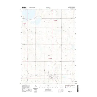
2015 Map of De Smet
USGS Topo · Published 2015About this map
De Smet serves as the central hub of this Kingsbury County landscape, situated atop the Coteau des Prairies plateau. The town's grid is meticulously detailed, showing the street network from Front St down to 4th St SE, including locally significant corridors like Sherwood Ave SW and Loftus Ave SW. To the north, the terrain is defined by the basins of Spirit Lake and Mud Lake, providing a clear view of the area's glacial hydrology. Genealogists and local historians will find the Spirit Lake Cem positioned near the northeastern shores of its namesake lake. The presence of Wilder Airport north of town reflects the region's mid-century aviation infrastructure, while the surrounding sections maintain the rigid north-south township and range lines that characterize the South Dakota prairie.
Find a feature on this map
38 named features on this map. Tap any name to fly to it.
Don’t see what you’re looking for? This feature index may not catch every label — zoom into the map to look around manually.
Map Details
Editions of this 2015 De Smet Map
This is the sole edition of this map. No revisions or reprints were ever made.
Other maps of this area

1899 · De Smet
USGS Topo · 1:125,000

1953 · Watertown
USGS Topo · 1:250,000

1958 · Watertown
USGS Topo · 1:250,000

1968 · Lake Preston West
USGS Topo · 1:24,000

1968 · Erwin
USGS Topo · 1:24,000

1971 · Bancroft East
USGS Topo · 1:24,000

1971 · De Smet
USGS Topo · 1:24,000

1971 · De Smet SE
USGS Topo · 1:24,000
1971 · Manchester
USGS Topo · 1:24,000

1973 · Bryant
USGS Topo · 1:24,000