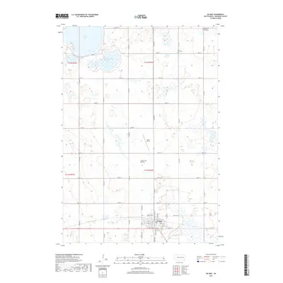
2017 Map of De Smet
USGS Topo · Published 2017About this map
De Smet serves as the primary hub of this eastern South Dakota landscape, positioned atop the distinct glacial geography of the Coteau des Prairies. The town plan is rendered in high detail, showing a grid of streets such as Calumet Ave SW and Front St NW that form the core of the community. Outside the town limits, the landscape is defined by the section-line road network typical of the plains, interspersed with significant local landmarks and water bodies.
Find a feature on this map
45 named features on this map. Tap any name to fly to it.
Don’t see what you’re looking for? This feature index may not catch every label — zoom into the map to look around manually.
Map Details
Editions of this 2017 De Smet Map
This is the sole edition of this map. No revisions or reprints were ever made.
Other maps of this area

1899 · De Smet
USGS Topo · 1:125,000

1953 · Watertown
USGS Topo · 1:250,000

1958 · Watertown
USGS Topo · 1:250,000

1968 · Lake Preston West
USGS Topo · 1:24,000

1968 · Erwin
USGS Topo · 1:24,000

1971 · Bancroft East
USGS Topo · 1:24,000

1971 · De Smet
USGS Topo · 1:24,000

1971 · De Smet SE
USGS Topo · 1:24,000
1971 · Manchester
USGS Topo · 1:24,000

1973 · Bryant
USGS Topo · 1:24,000