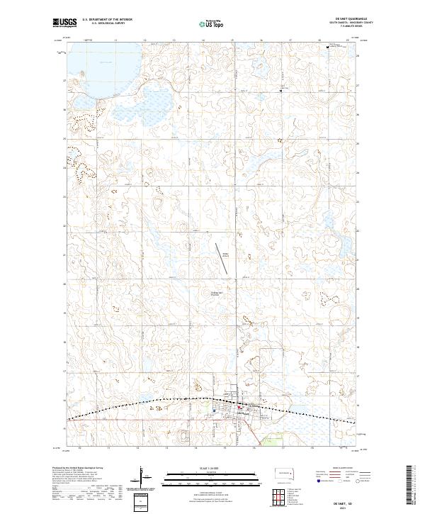
2021 Map of De Smet
USGS Topo · Published 2021About this map
De Smet serves as the focal point of this Eastern South Dakota landscape, situated within the broader physical geography of the Coteau des Prairies. The town's grid is anchored by the Kingsbury County Courthouse, while its aviation connection is maintained through Wilder Airport to the north. The surrounding prairie is defined by a dense section-line road network, including 433rd Ave and 202nd St, which navigate a terrain dotted with numerous prairie potholes and larger water bodies like Spirit Lake and Mud Lake. Local history and genealogy are preserved at the West Bethany Lutheran Church Cem in the northeastern corner and the Spirit Lake Cem further south. This survey illustrates the persistent agricultural and civic structure of the region, where the township and range system remains the primary organizing force for both movement and property.
Find a feature on this map
42 named features on this map. Tap any name to fly to it.
Don’t see what you’re looking for? This feature index may not catch every label — zoom into the map to look around manually.
Map Details
Editions of this 2021 De Smet Map
This is the sole edition of this map. No revisions or reprints were ever made.
Other maps of this area

1899 · De Smet
USGS Topo · 1:125,000

1953 · Watertown
USGS Topo · 1:250,000

1958 · Watertown
USGS Topo · 1:250,000

1968 · Lake Preston West
USGS Topo · 1:24,000

1968 · Erwin
USGS Topo · 1:24,000

1971 · Bancroft East
USGS Topo · 1:24,000

1971 · De Smet
USGS Topo · 1:24,000

1971 · De Smet SE
USGS Topo · 1:24,000
1971 · Manchester
USGS Topo · 1:24,000

1973 · Bryant
USGS Topo · 1:24,000