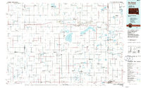
1985 Map of De Smet
USGS Topo · Published 1986About this map
De Smet serves as the central hub of this eastern South Dakota landscape, where the prairie is defined by a dense network of glacial lakes and critical waterfowl habitats. The mid-1980s geography reveals a region deeply shaped by its water and rail connections, with the Chicago and North Western and Burlington Northern lines cutting across the plains to support towns like Arlington and Howard. The map highlights specialized communal settlements such as Cloverleaf Colony and Pearl Creek Colony, illustrating the distinct social fabric of the territory. Significant hydrological features include the sprawling Lake Thompson and the dry Lake Preston lakebed, alongside numerous State Game Production Areas that emphasize the importance of conservation in this agricultural heartland. To the southeast, the recreation and natural beauty of Oakwood Lakes State Park and Lake Madison mark the transition toward more developed lakeside communities.
Find a feature on this map
81 named features on this map. Tap any name to fly to it.
Don’t see what you’re looking for? This feature index may not catch every label — zoom into the map to look around manually.
Map Details
Editions of this 1985 De Smet Map
3 editions found
Other maps of this area

1895 · Byron
USGS Topo · 1:125,000

1898 · Huron
USGS Topo · 1:125,000

1899 · Mitchell
USGS Topo · 1:125,000

1899 · Alexandria
USGS Topo · 1:125,000

1899 · De Smet
USGS Topo · 1:125,000

1953 · Huron
USGS Topo · 1:250,000

1953 · Watertown
USGS Topo · 1:250,000

1954 · Huron
USGS Topo · 1:250,000

1955 · Sioux Falls
USGS Topo · 1:250,000

1955 · Mitchell
USGS Topo · 1:250,000