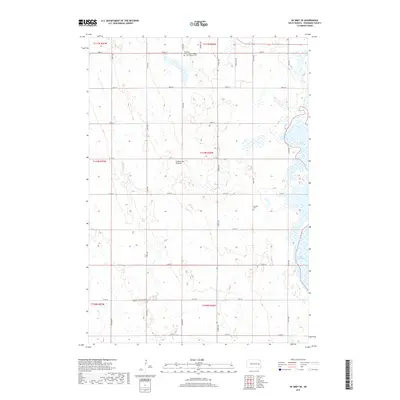
2017 Map of De Smet SE
USGS Topo · Published 2017About this map
The glacial highlands of the Coteau des Prairies dominate this landscape southeast of De Smet, characterized by a complex network of seasonal wetlands and prairie potholes. The eastern margin is defined by the significant shorelines of Lake Henry and Lake Thompson, which serve as major landmarks in this high-plains environment. Human settlement follows the rigid geometry of the Public Land Survey System, with a gridded road network including Co Rd 6A and numerous numbered routes like 208th St. Local genealogy is anchored by the De Smet Cem Saint Thomas Catholic Cem in the north and the Johnson Cem further south. The drainage of Rock Cr meanders through the western sections, illustrating the subtle topography that governs water movement across Kingsbury County.
Find a feature on this map
22 named features on this map. Tap any name to fly to it.
Don’t see what you’re looking for? This feature index may not catch every label — zoom into the map to look around manually.
Map Details
Editions of this 2017 De Smet SE Map
This is the sole edition of this map. No revisions or reprints were ever made.
Other maps of this area

1899 · De Smet
USGS Topo · 1:125,000

1953 · Watertown
USGS Topo · 1:250,000

1958 · Watertown
USGS Topo · 1:250,000

1968 · Lake Preston West
USGS Topo · 1:24,000

1968 · Oldham NW
USGS Topo · 1:24,000

1968 · Erwin
USGS Topo · 1:24,000

1971 · Howard NE
USGS Topo · 1:24,000

1971 · Bancroft East
USGS Topo · 1:24,000

1971 · De Smet
USGS Topo · 1:24,000

1971 · De Smet SE
USGS Topo · 1:24,000