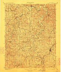
1901 Map of De Soto
USGS Topo · Published 1913About this map
De Soto serves as a major hub for the St. Louis Iron Mountain and Southern RR at the turn of the century, anchoring a landscape where river crossings and early industry define the community structure. The Meramec River and Big River dominate the drainage of this region, their winding courses punctuated by dozens of named crossings such as Fishtrap Ford, Shawneetown Ford, and Virginia Mines Ford. These fords, alongside milling sites like Pohlman Mill and Waits Sawmill, illustrate the 1890s reliance on local waterpower and specific topographic gaps for transit.
Find a feature on this map
100 named features on this map. Tap any name to fly to it.
Don’t see what you’re looking for? This feature index may not catch every label — zoom into the map to look around manually.
Map Details
Editions of this 1901 De Soto Map
5 editions found
Other maps of this area

1890 · Hermann
USGS Topo · 1:125,000

1901 · De Soto
USGS Topo · 1:125,000

1903 · O'Fallon
USGS Topo · 1:125,000

1903 · Sullivan
USGS Topo · 1:125,000

1904 · Farmington
USGS Topo · 1:62,500

1905 · Bonneterre
USGS Topo · 1:62,500

1906 · Potosi
USGS Topo · 1:62,500

1906 · Farmington
USGS Topo · 1:62,500

1912 · Kimmswick
USGS Topo · 1:62,500

1915 · Crystal City
USGS Topo · 1:62,500