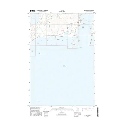
2017 Map of De Tour Village
USGS Topo · Published 2017About this map
De Tour Village serves as the gateway to the North Channel, situated at the southeastern tip of the Upper Peninsula where the St. Marys River meets Lake Huron. This 2017 study illustrates the maritime character of the region, specifically the critical De Tour Passage that separates the mainland from Drummond Island. The shoreline is heavily articulated by features such as Seymour Bay, Carlton Bay, and Gut Port, reflecting the complex geography of the Potagannissing Bay area. Inland, the map documents several community landmarks, including Maple Grove Cem, Bob Hill Cem, and Riverview Cem. Further west, the landscape transitions to a series of inland water bodies like Caribou Lake and Bear Lake, surrounded by a network of local routes such as S Scenic Rd and S Woodsman Trl. The map also details numerous navigational hazards and landmarks like De Tour Reef and Frying Pan Shoal that define this vital shipping corridor.
Find a feature on this map
52 named features on this map. Tap any name to fly to it.
Don’t see what you’re looking for? This feature index may not catch every label — zoom into the map to look around manually.
Map Details
Editions of this 2017 De Tour Village Map
This is the sole edition of this map. No revisions or reprints were ever made.
Other maps of this area

1954 · Alpena
USGS Topo · 1:250,000

1954 · Sault Sainte Marie
USGS Topo · 1:250,000

1955 · Cheboygan
USGS Topo · 1:250,000

1956 · Sault Sainte Marie
USGS Topo · 1:250,000

1957 · Alpena
USGS Topo · 1:250,000

1957 · Sault Sainte Marie
USGS Topo · 1:250,000

1958 · Cheboygan
USGS Topo · 1:250,000

1958 · Alpena
USGS Topo · 1:250,000

1958 · Sault Sainte Marie
USGS Topo · 1:250,000

1961 · Blind River
USGS Topo · 1:250,000
Featured Places
- De Tour Village, DeTour Village
- Detour Township, MI
- Drummond Township, MI
- DeTour Village, MI
- Chippewa County, MI