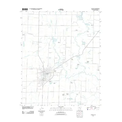
2011 Map of De Witt
USGS Topo · Published 2011About this map
De Witt serves as the central hub of this agricultural landscape in Arkansas County, defined by a network of drainage bayous and small reservoirs. The town's grid is anchored by the De Witt Post Office and surrounded by a concentration of local heritage sites, including the De Witt Cemetery and Morning Glory Cemetery. Beyond the city limits, the landscape transitions into large-scale farming tracts where irrigation is managed through numerous impoundments like McKewen Lake and Mitchell Lake. The map reveals a high density of family and community burial grounds scattered across the countryside, such as the Jackson Cemetery and McDaniel Cemetery, which offer valuable coordinates for genealogists. Waterways like La Grue Bayou and Little LaGrue Bayou wind through the terrain, their courses occasionally interrupted by structures such as the McKewen Lake Dam and Miller Lake Dam.
Find a feature on this map
95 named features on this map. Tap any name to fly to it.
Don’t see what you’re looking for? This feature index may not catch every label — zoom into the map to look around manually.
Map Details
Editions of this 2011 De Witt Map
This is the sole edition of this map. No revisions or reprints were ever made.
Other maps of this area

1935 · Gillett
USGS Topo · 1:62,500

1939 · Indian Bay
USGS Topo · 1:62,500

1939 · Henrico
USGS Topo · 1:62,500

1941 · De Witt
USGS Topo · 1:62,500

1948 · Helena
USGS Topo · 1:250,000

1950 · Helena
USGS Topo · 1:250,000

1954 · Indian Bay
USGS Topo · 1:62,500

1954 · De Witt
USGS Topo · 1:62,500

1954 · Henrico
USGS Topo · 1:62,500

1955 · Helena
USGS Topo · 1:250,000