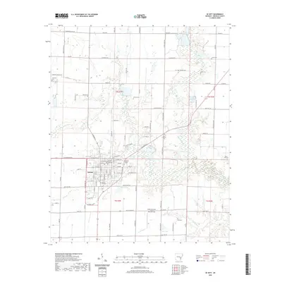
2020 Map of De Witt
USGS Topo · Published 2020About this map
De Witt serves as the focal point of this Arkansas County survey, anchored by the Arkansas County Courthouse at its center. The surrounding landscape is defined by an intricate network of waterways and bayous, including the meandering Little LaGrue Bayou and Caney Bayou. Numerous cemeteries scattered across the township, such as Morning Glory Cem and Cedarcrest Memorial Gardens, provide valuable touchpoints for genealogical research and local history.
Find a feature on this map
111 named features on this map. Tap any name to fly to it.
Don’t see what you’re looking for? This feature index may not catch every label — zoom into the map to look around manually.
Map Details
Editions of this 2020 De Witt Map
This is the sole edition of this map. No revisions or reprints were ever made.
Other maps of this area

1935 · Gillett
USGS Topo · 1:62,500

1939 · Indian Bay
USGS Topo · 1:62,500

1939 · Henrico
USGS Topo · 1:62,500

1941 · De Witt
USGS Topo · 1:62,500

1948 · Helena
USGS Topo · 1:250,000

1950 · Helena
USGS Topo · 1:250,000

1954 · Indian Bay
USGS Topo · 1:62,500

1954 · De Witt
USGS Topo · 1:62,500

1954 · Henrico
USGS Topo · 1:62,500

1955 · Helena
USGS Topo · 1:250,000