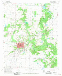
1968 Map of De Witt
USGS Topo · Published 1969About this map
De Witt serves as the focal point of this Arkansas County survey, situated amidst the agricultural landscapes of the Keaton and Prairie regions. The town is densely detailed with its Courthouse, Post Office, and specialized facilities like the Home for the Aged and Hospital. A network of schools, including Westside Sch, Southside Sch, and De Witt High Sch, highlights the community's mid-century growth and infrastructure.
Find a feature on this map
34 named features on this map. Tap any name to fly to it.
Don’t see what you’re looking for? This feature index may not catch every label — zoom into the map to look around manually.
Map Details
Editions of this 1968 De Witt Map
This is the sole edition of this map. No revisions or reprints were ever made.
Other maps of this area

1935 · Gillett
USGS Topo · 1:62,500

1939 · Indian Bay
USGS Topo · 1:62,500

1939 · Henrico
USGS Topo · 1:62,500

1941 · De Witt
USGS Topo · 1:62,500

1948 · Helena
USGS Topo · 1:250,000

1950 · Helena
USGS Topo · 1:250,000

1954 · Indian Bay
USGS Topo · 1:62,500

1954 · De Witt
USGS Topo · 1:62,500

1954 · Henrico
USGS Topo · 1:62,500

1955 · Helena
USGS Topo · 1:250,000