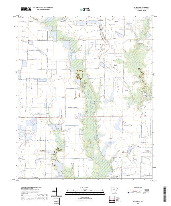
2024 Map of De Witt SW
USGS Topo · Published 2024About this map
Mill Bayou and its surrounding wetlands form the central spine of this Arkansas County landscape, where the Grand Prairie meets the intricate drainage networks of the Mississippi Delta. The small settlements of Kittlers, Olena, and Burks are connected by a grid of rural roads and state routes, including State Hwy 343. This area is defined by its sophisticated agricultural water management systems, visible through numerous man-made features such as Fullers Reservoir, Thomas Reservoir, and Sollars Reservoir. The map illustrates a complex hydrographic pattern of natural bayous like Hurricane-Bayou and Little LaGrue Bayou alongside engineered channels including Lateral Number 13 and several numbered ditches. This infrastructure reflects the intensive rice and soybean farming traditions that have shaped the economy and geography of this region for generations.
Find a feature on this map
66 named features on this map. Tap any name to fly to it.
Don’t see what you’re looking for? This feature index may not catch every label — zoom into the map to look around manually.
Map Details
Editions of this 2024 De Witt SW Map
This is the sole edition of this map. No revisions or reprints were ever made.
Other maps of this area

1935 · Varner
USGS Topo · 1:62,500

1935 · Gillett
USGS Topo · 1:62,500

1941 · De Witt
USGS Topo · 1:62,500

1941 · Goldman
USGS Topo · 1:62,500

1948 · Helena
USGS Topo · 1:250,000

1950 · Helena
USGS Topo · 1:250,000

1954 · De Witt
USGS Topo · 1:62,500

1955 · Helena
USGS Topo · 1:250,000

1959 · Helena
USGS Topo · 1:250,000

1960 · Helena
USGS Topo · 1:250,000