
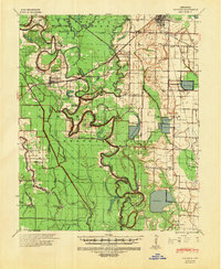
1941 Map of Goldman
USGS Topo · Published 1944About this map
Bayou Meto and its intricate network of sloughs and cut-offs define this delta landscape as it appeared in the early 1940s. The region is marked by historic property lines and hydrologic records, including the Meander Line 1838 and Meander Line 1825, which document the shifting nature of the river system over a century. Settlement is concentrated along the St Louis Southwestern Ry at Humphrey and Goldman, with smaller agrarian hubs like Ricusskey and Hagler anchoring the surrounding countryside.
Find a feature on this map
51 named features on this map. Tap any name to fly to it.
Don’t see what you’re looking for? This feature index may not catch every label — zoom into the map to look around manually.
Map Details
Editions of this 1941 Goldman Map
2 editions found
Other maps of this area

1935 · Altheimer
USGS Topo · 1:62,500

1935 · Varner
USGS Topo · 1:62,500

1935 · Noble Lake
USGS Topo · 1:62,500

1935 · Clarendon
USGS Topo · 1:62,500

1935 · Gillett
USGS Topo · 1:62,500

1937 · Stuttgart
USGS Topo · 1:62,500

1937 · England
USGS Topo · 1:48,000

1939 · Stuttgart
USGS Topo · 1:62,500

1941 · De Witt
USGS Topo · 1:62,500

1941 · Clarendon
USGS Topo · 1:62,500