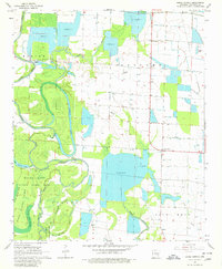
1968 Map of Lodge Corner
USGS Topo · Published 1980About this map
Bayou Meto and its intricate network of tributaries define this landscape in Arkansas County, showing a region deeply shaped by water management and conservation. The map illustrates the sprawling Bayou Meto State Game Area, which encompasses significant wetlands including Grand Cypress Lake and Cox Cypress Lake. The land use is characterized by numerous large reservoirs and flumes, indicating the importance of irrigation for local agriculture. Small communities and landmarks provide a window into the area's social fabric, with the rural crossroads of Lodge Corner and Hagler serving as focal points. Local heritage is preserved through family-named features and rural institutions, such as Bayless Cem, Jesus Name Ch, and Benson Bridge, which cross the winding path of Benson Lake.
Find a feature on this map
26 named features on this map. Tap any name to fly to it.
Don’t see what you’re looking for? This feature index may not catch every label — zoom into the map to look around manually.
Map Details
Editions of this 1968 Lodge Corner Map
3 editions found
Other maps of this area

1935 · Varner
USGS Topo · 1:62,500

1935 · Gillett
USGS Topo · 1:62,500

1941 · De Witt
USGS Topo · 1:62,500

1941 · Goldman
USGS Topo · 1:62,500

1948 · Helena
USGS Topo · 1:250,000

1950 · Helena
USGS Topo · 1:250,000

1954 · De Witt
USGS Topo · 1:62,500

1955 · Helena
USGS Topo · 1:250,000

1959 · Helena
USGS Topo · 1:250,000

1960 · Helena
USGS Topo · 1:250,000