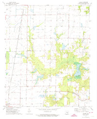
1972 Map of Tichnor
USGS Topo · Published 1974About this map
Tichnor and the surrounding Arkansas County lowlands are defined by a complex network of bayous and irrigation flumes in this early 1970s survey. The St Louis Southwestern railroad corridor anchors the western portion of the map, serving small settlements and loading points like Indiana Spur, Mayview, and Hyden. The agricultural character of the region is evident in the numerous water management features, including the Ward Reservoir and the winding Point Deluce Bayou.
Find a feature on this map
22 named features on this map. Tap any name to fly to it.
Don’t see what you’re looking for? This feature index may not catch every label — zoom into the map to look around manually.
Map Details
Editions of this 1972 Tichnor Map
This is the sole edition of this map. No revisions or reprints were ever made.
Other maps of this area

1935 · Gillett
USGS Topo · 1:62,500

1939 · Indian Bay
USGS Topo · 1:62,500

1939 · Henrico
USGS Topo · 1:62,500

1941 · De Witt
USGS Topo · 1:62,500

1948 · Helena
USGS Topo · 1:250,000

1950 · Helena
USGS Topo · 1:250,000

1954 · Indian Bay
USGS Topo · 1:62,500

1954 · De Witt
USGS Topo · 1:62,500

1954 · Henrico
USGS Topo · 1:62,500

1955 · Helena
USGS Topo · 1:250,000