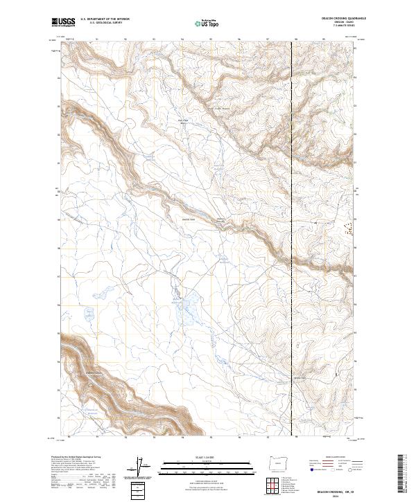
2024 Map of Deacon Crossing
USGS Topo · Published 2024About this map
The Middle Fork Owyhee River cuts a deep course through this high-desert landscape on the Oregon-Idaho border, where the protected corridor of the Owyhee Wild and Scenic River preserves the canyon's natural state. Water management is a central theme here, evidenced by a string of upland catchments including Sharon Cr Reservoir, Deacon Reservoir, and State Line Reservoir. These water sources support a handful of established clearings and camps such as Deacon Field and Rentile Field that sit above the river's path. Moving away from the main channel, the terrain rises into the Pole Creek Breaks and opens into the Pole Creek Basin. Along Fields Creek Reservoir Rd, the Maher Reservoir area shows where geography and infrastructure meet to sustain the remote high plains. The map illustrates a landscape shaped by seasonal water flow and the geological scars of Owyhee Canyon.
Find a feature on this map
30 named features on this map. Tap any name to fly to it.
Don’t see what you’re looking for? This feature index may not catch every label — zoom into the map to look around manually.
Map Details
Editions of this 2024 Deacon Crossing Map
This is the sole edition of this map. No revisions or reprints were ever made.
Other maps of this area

1955 · Jordan Valley
USGS Topo · 1:250,000

1957 · Jordan Valley
USGS Topo · 1:250,000

1958 · Jordan Valley
USGS Topo · 1:250,000

1973 · Bedstead Ridge
USGS Topo · 1:24,000

1973 · Fairylawn
USGS Topo · 1:24,000
1977 · Bull Basin Camp
USGS Topo · 1:24,000

1980 · Brewster Reservoir
USGS Topo · 1:24,000

1980 · Three Forks
USGS Topo · 1:24,000
1982 · Deacon Crossing
USGS Topo · 1:24,000
1982 · Rawhide Pocket
USGS Topo · 1:24,000