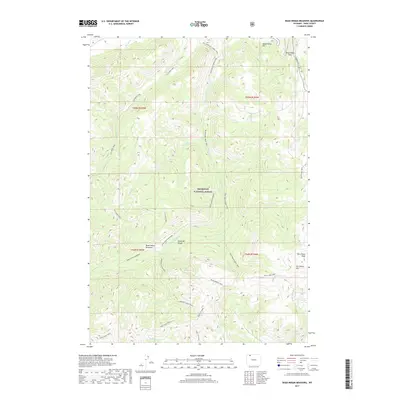
2017 Map of Dead Indian Meadows
USGS Topo · Published 2017About this map
Shoshone National Forest encompasses this high-elevation landscape within the Absaroka Range, where high mountain peaks and intricate trail networks define the terrain. The central namesake, Dead Indian Meadows, serves as a focal point for several backcountry routes, including the Dead Indian Creek Trail and the Morning Creek Trail. This 2017 survey details the complex drainage systems of the region, where water sources like Bear Springs and Spout Springs feed into high-altitude creeks such as Morning Cr and Elk Cr. Notable topographic landmarks like Dead Indian Pass, Pat O'Hara Peak, and Dead Indian Hill dominate the eastern boundary, illustrating the dramatic elevation changes that characterize this wilderness area. The map provides a precise look at the historic corridors used for travel through the mountains long before modern infrastructure reached these heights.
Find a feature on this map
33 named features on this map. Tap any name to fly to it.
Don’t see what you’re looking for? This feature index may not catch every label — zoom into the map to look around manually.
Map Details
Editions of this 2017 Dead Indian Meadows Map
This is the sole edition of this map. No revisions or reprints were ever made.
Other maps of this area

1896 · Crandall Creek
USGS Topo · 1:125,000

1899 · Crandall
USGS Topo · 1:125,000

1949 · Pat O'Hara Mountain
USGS Topo · 1:62,500

1950 · Deep Lake
USGS Topo · 1:62,500

1955 · Cody
USGS Topo · 1:250,000

1956 · Beartooth Butte
USGS Topo · 1:62,500

1956 · Dead Indian Peak
USGS Topo · 1:62,500

1958 · Cody
USGS Topo · 1:250,000

1962 · Cody
USGS Topo · 1:250,000

1980 · Cody
USGS Topo · 1:100,000