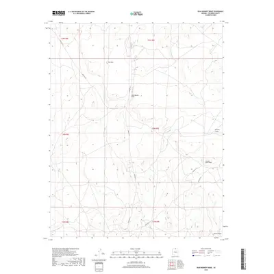
2018 Map of Dead Monkey Ridge
USGS Topo · Published 2018About this map
Dead Monkey Ridge and Red Mesa dominate this high-desert landscape in Coconino County, where the topography is defined by sharp rises and deep incisions like Antelope Canyon. This 2018 survey reveals a sparse network of arterial roads, primarily Indian Rte 20 and Indian Rte 6211, which navigate the complex elevations of the Navajo Nation. The terrain transitions from the high points of Circular White Ridge in the east toward the southern formations of Mormon Ridges. The absence of dense residential development emphasizes the topographical character of the region, where infrastructure like S Grandview Dr provides limited access to these distinct geological features.
Find a feature on this map
15 named features on this map. Tap any name to fly to it.
Don’t see what you’re looking for? This feature index may not catch every label — zoom into the map to look around manually.
Map Details
Editions of this 2018 Dead Monkey Ridge Map
This is the sole edition of this map. No revisions or reprints were ever made.
Other maps of this area

1886 · Echo Cliffs
USGS Topo · 1:250,000

1891 · Echo Cliffs
USGS Topo · 1:250,000

1954 · Lees Ferry SE
USGS Topo · 1:24,000

1954 · Tanner Wash
USGS Topo · 1:62,500

1954 · Leche-E Rock
USGS Topo · 1:62,500

1954 · Lees Ferry
USGS Topo · 1:62,500

1955 · Tanner Wash NE
USGS Topo · 1:24,000

1956 · Marble Canyon
USGS Topo · 1:250,000

1959 · Marble Canyon
USGS Topo · 1:250,000

1961 · Marble Canyon
USGS Topo · 1:250,000