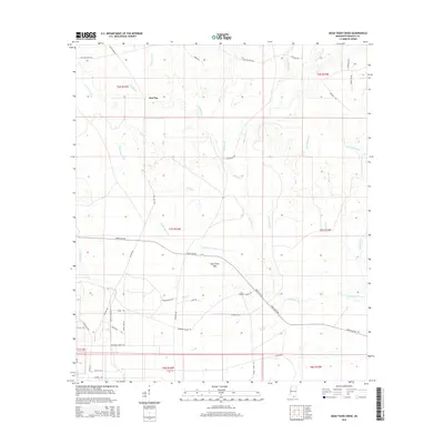
2015 Map of Dead Tiger Creek
USGS Topo · Published 2015About this map
Flat Top anchors this landscape in Mississippi's coastal piney woods, where a dense network of watercourses defines the terrain just inland from the Gulf. The drainage of Dead Tiger Creek and the marshy expanses of Sam Farve Bay illustrate the intricate hydrology of Hancock County. A mix of rural and specialized infrastructure is evident in the road network, which includes the historic Three Notch Road and more modern additions like Shuttle Parkway, indicating the area's proximity to regional space and defense operations. Large tracts such as Tract 37 and Tract 38 sit alongside family-named landmarks like Lott McCarty Road and Leonard Kimble Road, reflecting a transition from traditional timber and farming lands to industrial and governmental land use. The varied names of local tributaries, including Turtleskin Creek and Bayou Bacon, underscore the distinct cultural and natural heritage of this riverine environment near the Catahoula Creek basin.
Find a feature on this map
52 named features on this map. Tap any name to fly to it.
Don’t see what you’re looking for? This feature index may not catch every label — zoom into the map to look around manually.
Map Details
Editions of this 2015 Dead Tiger Creek Map
This is the sole edition of this map. No revisions or reprints were ever made.
Other maps of this area

1914 · Nicholson
USGS Topo · 1:62,500

1921 · Nicholson
USGS Topo · 1:62,500

1941 · Honey Island
USGS Topo · 1:31,680

1950 · Haaswood
USGS Topo · 1:31,680

1953 · Mobile
USGS Topo · 1:250,000

1954 · Haaswood
USGS Topo · 1:31,680

1955 · Savannah
USGS Topo · 1:62,500

1955 · Nicholson
USGS Topo · 1:24,000

1956 · Waveland
USGS Topo · 1:24,000

1957 · Mobile
USGS Topo · 1:250,000