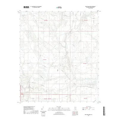
2018 Map of Dead Tiger Creek
USGS Topo · Published 2018About this map
Dead Tiger Cr flows through the lowlands of Hancock County, defining a landscape of complex wetlands and slow-moving bayous. This 2018 survey reveals an area heavily shaped by both natural drainage and military or industrial infrastructure, indicated by features like Bombing Range Rd and Igloo Rd. The presence of Dummy Line RD suggests the legacy of old logging railroads that once traversed these coastal flats. Notable water bodies such as Sam Farve Bay, Double Bay, and Josephs Bay are scattered across the terrain, reflecting the saturated nature of the Gulf Coast hinterlands. The road network, including Andrew Jackson Rd and Texas Flat Rd, connects these remote reaches where Catahoula Creek and numerous branches like Pigeon Roost Br provide the primary geographical structure.
Find a feature on this map
52 named features on this map. Tap any name to fly to it.
Don’t see what you’re looking for? This feature index may not catch every label — zoom into the map to look around manually.
Map Details
Editions of this 2018 Dead Tiger Creek Map
This is the sole edition of this map. No revisions or reprints were ever made.
Other maps of this area

1914 · Nicholson
USGS Topo · 1:62,500

1921 · Nicholson
USGS Topo · 1:62,500

1941 · Honey Island
USGS Topo · 1:31,680

1950 · Haaswood
USGS Topo · 1:31,680

1953 · Mobile
USGS Topo · 1:250,000

1954 · Haaswood
USGS Topo · 1:31,680

1955 · Savannah
USGS Topo · 1:62,500

1955 · Nicholson
USGS Topo · 1:24,000

1956 · Waveland
USGS Topo · 1:24,000

1957 · Mobile
USGS Topo · 1:250,000