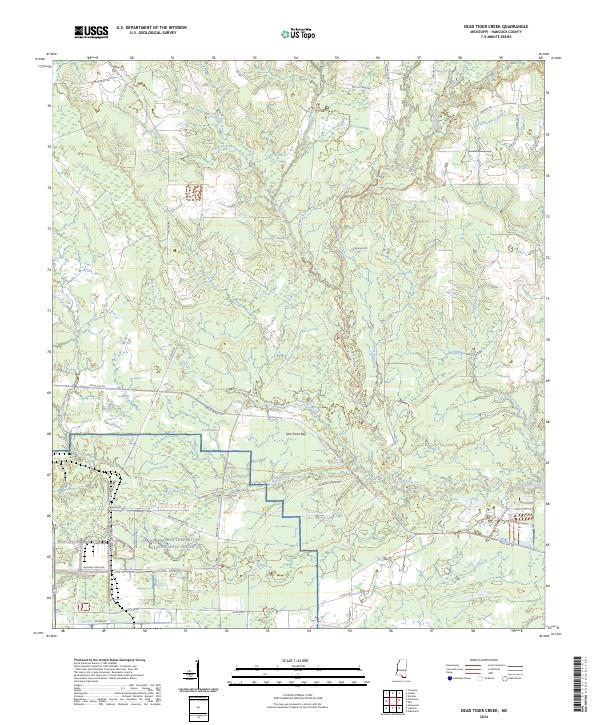
2024 Map of Dead Tiger Creek
USGS Topo · Published 2024About this map
Stennis Space Center and the Naval Research Laboratory dominate the southern portion of this Hancock County landscape, where the modern technological infrastructure of the United States space program meets the drainage systems of the Gulf Coast. The terrain is defined by a intricate network of waterways, including Dead Tiger Creek, Catahoula Creek, and Wolf Branch, which feed into distinctive swampy lowlands such as Sam Farve Bay and Double Bay.
Find a feature on this map
51 named features on this map. Tap any name to fly to it.
Don’t see what you’re looking for? This feature index may not catch every label — zoom into the map to look around manually.
Map Details
Editions of this 2024 Dead Tiger Creek Map
This is the sole edition of this map. No revisions or reprints were ever made.
Other maps of this area

1914 · Nicholson
USGS Topo · 1:62,500

1921 · Nicholson
USGS Topo · 1:62,500

1941 · Honey Island
USGS Topo · 1:31,680

1950 · Haaswood
USGS Topo · 1:31,680

1953 · Mobile
USGS Topo · 1:250,000

1954 · Haaswood
USGS Topo · 1:31,680

1955 · Savannah
USGS Topo · 1:62,500

1955 · Nicholson
USGS Topo · 1:24,000

1956 · Waveland
USGS Topo · 1:24,000

1957 · Mobile
USGS Topo · 1:250,000