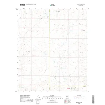
2020 Map of Deadman Lake
USGS Topo · Published 2020About this map
The intersection of Chaves, Lincoln, and Otero Counties defines this high-desert landscape, where ephemeral water sources and rugged drainages dictate the geography. Named for its primary hydrological features, the area is characterized by several distinct depressions and catchments, including Big Flying H Lake and Little Flying H Lake. These features, along with Circle Diamond Lake and Deep Lake, suggest a pastoral land use where ranching and livestock management rely on these scattered basins.
Find a feature on this map
29 named features on this map. Tap any name to fly to it.
Don’t see what you’re looking for? This feature index may not catch every label — zoom into the map to look around manually.
Map Details
Editions of this 2020 Deadman Lake Map
This is the sole edition of this map. No revisions or reprints were ever made.
Other maps of this area

1955 · Roswell
USGS Topo · 1:250,000

1958 · Roswell
USGS Topo · 1:250,000

1961 · Flying H
USGS Topo · 1:62,500

1961 · Lincoln
USGS Topo · 1:62,500

1961 · Tinnie
USGS Topo · 1:62,500

1962 · Roswell
USGS Topo · 1:250,000

1963 · Clements Ranch
USGS Topo · 1:24,000

1963 · Turkey Peak
USGS Topo · 1:24,000

1963 · Deadman Lake
USGS Topo · 1:24,000
1963 · Pajarita Mountain
USGS Topo · 1:24,000