
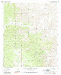
1963 Map of Clements Ranch
USGS Topo · Published 1966About this map
The Mescalero Apache Indian Reservation occupies the western half of this landscape, its boundary cutting through high ranching country where the borders of Lincoln, Otero, and Chaves counties meet. In the early 1960s, this region was defined by a critical network of water sources essential for livestock and settlement, including the Rio Felix and numerous dispersed points like Clements Ranch and Little Felix Tank.
Find a feature on this map
36 named features on this map. Tap any name to fly to it.
Don’t see what you’re looking for? This feature index may not catch every label — zoom into the map to look around manually.
Map Details
Editions of this 1963 Clements Ranch Map
2 editions found
Other maps of this area

1954 · Carlsbad
USGS Topo · 1:250,000

1955 · Roswell
USGS Topo · 1:250,000

1958 · Carlsbad
USGS Topo · 1:250,000

1958 · Roswell
USGS Topo · 1:250,000

1961 · Flying H
USGS Topo · 1:62,500

1962 · Roswell
USGS Topo · 1:250,000

1962 · Dunken
USGS Topo · 1:62,500

1963 · Mayhill
USGS Topo · 1:24,000

1963 · Turkey Peak
USGS Topo · 1:24,000

1963 · Deadman Lake
USGS Topo · 1:24,000