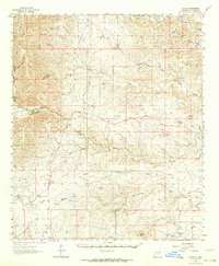
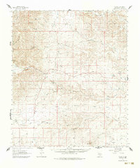
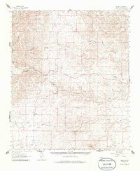
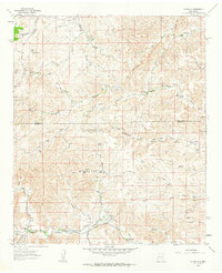
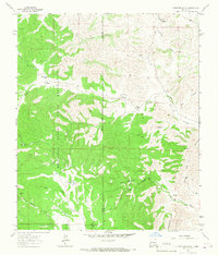
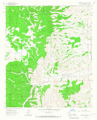
1962 Map of Dunken
USGS Topo · Published 1964About this map
Dunken anchors this cattle-country landscape along the Chaves Co line in the early 1960s, serving as a hub for the scattered homesteads and ranches of the southern Sacramento Mountains. The Rio Peñasco cuts through the canyon-scored terrain, providing a critical water source for the Scharbauer Ranch and the Peñasco River Ranch. This survey captures the rural infrastructure of the day, including the Peñasco Sch and the Dunken PO, alongside a local Cem that marks the community's generational ties to the land.
Find a feature on this map
61 named features on this map. Tap any name to fly to it.
Don’t see what you’re looking for? This feature index may not catch every label — zoom into the map to look around manually.
Map Details
Editions of this 1962 Dunken Map
3 editions found
Other maps of this area

1954 · Carlsbad
USGS Topo · 1:250,000

1955 · Roswell
USGS Topo · 1:250,000

1958 · Carlsbad
USGS Topo · 1:250,000

1958 · Roswell
USGS Topo · 1:250,000

1960 · Teel Ranch
USGS Topo · 1:62,500
1961 · Flying H
USGS Topo · 1:62,500

1961 · Indian Bluff
USGS Topo · 1:62,500

1962 · Roswell
USGS Topo · 1:250,000
1963 · Clements Ranch
USGS Topo · 1:24,000
1963 · Robertson Canyon
USGS Topo · 1:24,000