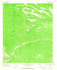
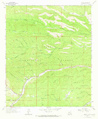
1963 Map of Mayhill
USGS Topo · Published 1966About this map
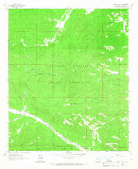
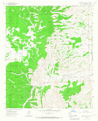
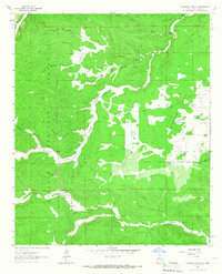
Mayhill sits at the confluence of several prominent drainages within the Lincoln National Forest, where the waters of James Canyon and Agua Chiquita Creek meet the Rio Peñasco. This 1963 survey illustrates a landscape defined by its canyon systems and water management, featuring numerous livestock tanks such as Big Canyon Tank and CCC Tank scattered across the high country. For genealogists and local historians, the map identifies specific landmarks like the Mtn View Acres Cem and Mayhill Cem, along with the Mayhill Ranger Station. The presence of the Gravel Pit and various jeep trails suggests a rural economy tied to resource extraction and forest management. The intricate topography of Sixteen Springs Canyon and Crooked Canyon dominates the northern half of the quadrangle, reflecting the complex drainage patterns of the Sacramento Mountains.
Find a feature on this map
49 named features on this map. Tap any name to fly to it.
Don’t see what you’re looking for? This feature index may not catch every label — zoom into the map to look around manually.
Map Details
Editions of this 1963 Mayhill Map
2 editions found
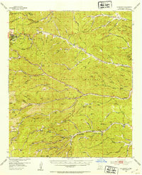
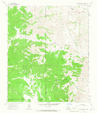
Other maps of this area
1952 · Cloudcroft
USGS Topo · 1:62,500

1954 · Carlsbad
USGS Topo · 1:250,000

1955 · Roswell
USGS Topo · 1:250,000

1958 · Carlsbad
USGS Topo · 1:250,000

1958 · Roswell
USGS Topo · 1:250,000

1962 · Roswell
USGS Topo · 1:250,000
1963 · Clements Ranch
USGS Topo · 1:24,000
1963 · Turkey Peak
USGS Topo · 1:24,000
1963 · Robertson Canyon
USGS Topo · 1:24,000
1963 · Woodson Canyon
USGS Topo · 1:24,000