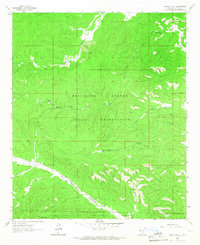
1963 Map of Mayhill
USGS Topo · Published 1973About this map
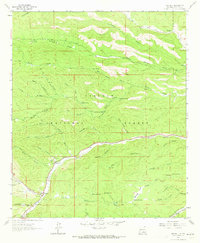
The mountain settlement of Mayhill sits at the confluence of several high-altitude drainages, serving as a focal point within the Lincoln National Forest during the 1960s. The landscape is defined by the Rio Peñasco, which winds through the central valley, flanked by numerous named canyons such as James Canyon and Sawmill Canyon. This period of the forest's history is marked by established infrastructure like the Mayhill Ranger Station and localized developments such as Mtn View Acres.
Find a feature on this map
62 named features on this map. Tap any name to fly to it.
Don’t see what you’re looking for? This feature index may not catch every label — zoom into the map to look around manually.
Map Details
Editions of this 1963 Mayhill Map
2 editions found
Other maps of this area
1952 · Cloudcroft
USGS Topo · 1:62,500

1954 · Carlsbad
USGS Topo · 1:250,000

1955 · Roswell
USGS Topo · 1:250,000

1958 · Carlsbad
USGS Topo · 1:250,000

1958 · Roswell
USGS Topo · 1:250,000

1962 · Roswell
USGS Topo · 1:250,000
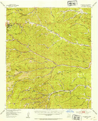
1963 · Clements Ranch
USGS Topo · 1:24,000
1963 · Mayhill
USGS Topo · 1:24,000
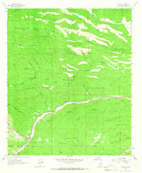
1963 · Turkey Peak
USGS Topo · 1:24,000
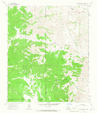
1963 · Robertson Canyon
USGS Topo · 1:24,000