
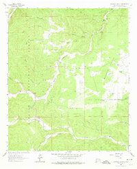
1963 Map of Woodson Canyon
USGS Topo · Published 1967About this map
Lincoln National Forest dominates this Otero County landscape, where a complex network of drainages and high flats supported mid-century ranching and water management. The terrain is defined by deep cuts such as Chiquita Canyon and Perk Canyon, with the Agua Chiquita Creek serving as a primary hydrological artery. Land use in the early 1960s is reflected in the numerous named tanks and wells, such as Stephens Well and Dougherty Well, which were essential for livestock in these high-elevation pastures.
Find a feature on this map
36 named features on this map. Tap any name to fly to it.
Don’t see what you’re looking for? This feature index may not catch every label — zoom into the map to look around manually.
Map Details
Editions of this 1963 Woodson Canyon Map
2 editions found
Other maps of this area

1952 · Cloudcroft
USGS Topo · 1:62,500

1954 · Carlsbad
USGS Topo · 1:250,000

1958 · Carlsbad
USGS Topo · 1:250,000

1963 · Mayhill
USGS Topo · 1:24,000

1963 · Robertson Canyon
USGS Topo · 1:24,000
1963 · Elk
USGS Topo · 1:24,000

1965 · Chimney Lake
USGS Topo · 1:24,000

1965 · Bear Spring
USGS Topo · 1:24,000

1965 · Avis
USGS Topo · 1:24,000
1974 · Sacramento
USGS Topo · 1:24,000