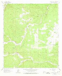
1963 Map of Woodson Canyon
USGS Topo · Published 1974About this map
Lincoln National Forest land defines this corner of Otero County, where a network of deep canyons and seasonal water sources supported high-altitude ranching and livestock operations during the mid-twentieth century. The terrain is marked by family-named landmarks such as the Lewis Ranch and numerous catchment basins including Barkley Lake, Wilson Lake, and Mc Donald Lake.
Find a feature on this map
34 named features on this map. Tap any name to fly to it.
Don’t see what you’re looking for? This feature index may not catch every label — zoom into the map to look around manually.
Map Details
Editions of this 1963 Woodson Canyon Map
2 editions found
Other maps of this area

1952 · Cloudcroft
USGS Topo · 1:62,500

1954 · Carlsbad
USGS Topo · 1:250,000

1958 · Carlsbad
USGS Topo · 1:250,000

1963 · Mayhill
USGS Topo · 1:24,000

1963 · Robertson Canyon
USGS Topo · 1:24,000

1963 · Woodson Canyon
USGS Topo · 1:24,000
1963 · Elk
USGS Topo · 1:24,000

1965 · Chimney Lake
USGS Topo · 1:24,000

1965 · Bear Spring
USGS Topo · 1:24,000

1965 · Avis
USGS Topo · 1:24,000