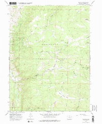
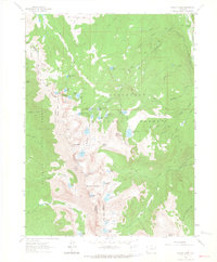
1967 Map of Deadman
USGS Topo · Published 1974About this map
Roosevelt National Forest defines this high-elevation landscape in Larimer County, where a complex network of water management and primitive transportation routes was established by the late 1960s. The map illustrates the diversion of water through the Eaton Ditch and the Columbine Ditch, infrastructure critical for directing runoff through the varied terrain of Green Ridge and Nunn Creek Basin. The presence of the Deadman Lookout Tower near Little Bald Mtn emphasizes the area's history of fire observation and forestry management.
Find a feature on this map
24 named features on this map. Tap any name to fly to it.
Don’t see what you’re looking for? This feature index may not catch every label — zoom into the map to look around manually.
Map Details
Editions of this 1967 Deadman Map
4 editions found
Other maps of this area

1916 · Home
USGS Topo · 1:125,000

1920 · Home
USGS Topo · 1:125,000

1954 · Greeley
USGS Topo · 1:250,000

1957 · Greeley
USGS Topo · 1:250,000

1958 · Greeley
USGS Topo · 1:250,000

1961 · Greeley
USGS Topo · 1:250,000

1962 · Boston Peak
USGS Topo · 1:24,000

1962 · Kinikinik
USGS Topo · 1:24,000
1962 · Rawah Lakes
USGS Topo · 1:24,000

1964 · Greeley
USGS Topo · 1:250,000