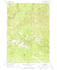
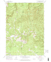
1954 Map of Deadman Mountain
USGS Topo · Published 1977About this map
The Black Hills National Forest dominates this mid-century topographic study, showcasing a high-elevation landscape defined by steep drainages and prominent peaks along the Lawrence and Meade County line. Central to the area's surveillance and management is the Veteran Lookout Tower, situated atop a ridge overlooking a complex network of gulches including Deadman Gulch and Bulldog Gulch. The map reveals the critical water infrastructure serving the region, notably the Sturgis Reservoirs fed by Vanocker Creek. Geological and recreational interest points like Bethlehem Cave and Wonderland Cave sit in the southeastern reaches, while the northern terrain is punctuated by massive landmarks such as Deadman Mountain and Bear Butte. This 1950s record captures the forest before more modern developments, preserving the original footprints of drainage systems like Elk Creek and Little Elk Creek.
Find a feature on this map
31 named features on this map. Tap any name to fly to it.
Don’t see what you’re looking for? This feature index may not catch every label — zoom into the map to look around manually.
Map Details
Editions of this 1954 Deadman Mountain Map
5 editions found
Other maps of this area

1893 · Rapid
USGS Topo · 1:125,000

1894 · Deadwood
USGS Topo · 1:125,000

1898 · Rapid
USGS Topo · 1:125,000

1899 · Sturgis
USGS Topo · 1:62,500

1901 · Deadwood
USGS Topo · 1:125,000

1903 · Rapid
USGS Topo · 1:125,000

1915 · Sturgis
USGS Topo · 1:62,500

1916 · Deadwood
USGS Topo · 1:125,000

1953 · Piedmont
USGS Topo · 1:24,000
1953 · Fort Meade
USGS Topo · 1:24,000