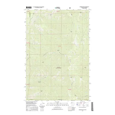
2017 Map of Deadman Peak
USGS Topo · Published 2017About this map
Umatilla National Forest spans this high-elevation landscape along the border of Oregon and Washington, dominated by a series of prominent summits including Deadman Peak and Griffin Peak. The terrain is defined by a radial drainage pattern where the S Fork Touchet River and numerous forks like Griffin Fork and Green Fork carve deep through the ridges. To the south, the protected Mill Creek Watershed occupies a significant portion of the area, emphasizing the region's importance for water resource management. Primitive transportation routes such as the Kendall Skyline Rd and the Intake/Deadman Peak Trail follow the high ridgelines, connecting various peaks including Lewis Peak and Table Rock. This network of trails and forestry roads illustrates the remote, managed nature of the Blue Mountains' northern reaches.
Find a feature on this map
44 named features on this map. Tap any name to fly to it.
Don’t see what you’re looking for? This feature index may not catch every label — zoom into the map to look around manually.
Map Details
Editions of this 2017 Deadman Peak Map
This is the sole edition of this map. No revisions or reprints were ever made.
Other maps of this area

1919 · Walla Walla
USGS Topo · 1:125,000

1921 · Walla Walla
USGS Topo · 1:125,000

1937 · Pomeroy
USGS Topo · 1:96,000

1942 · Pomeroy
USGS Topo · 1:125,000

1953 · Pendleton
USGS Topo · 1:250,000

1953 · Walla Walla
USGS Topo · 1:250,000

1955 · Pullman
USGS Topo · 1:250,000

1955 · Grangeville
USGS Topo · 1:250,000

1956 · Pendleton
USGS Topo · 1:250,000

1958 · Pullman
USGS Topo · 1:250,000