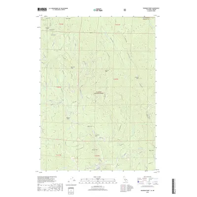
2018 Map of Deadman Point
USGS Topo · Published 2018About this map
Klamath National Forest dominates this high-elevation terrain along the border of Oregon and California, where the crest of Mill Creek Ridge and East Indian Ridge shape the local drainage patterns. The area is defined by a dense network of gulches and creeks, including the creatively named Four Bit Gulch, Two Bit Gulch, and Silver Gulch in the northwest. These drainages descend toward Greens Creek and Indian Cr, while the southern reaches are marked by landmarks such as Deadman Point and Applegate Flat.
Find a feature on this map
59 named features on this map. Tap any name to fly to it.
Don’t see what you’re looking for? This feature index may not catch every label — zoom into the map to look around manually.
Map Details
Editions of this 2018 Deadman Point Map
This is the sole edition of this map. No revisions or reprints were ever made.
Other maps of this area

1908 · Grants Pass
USGS Topo · 1:125,000

1914 · Seiad
USGS Topo · 1:125,000

1917 · Kerby
USGS Topo · 1:125,000

1918 · Kerby
USGS Topo · 1:125,000

1922 · Preston Peak
USGS Topo · 1:125,000

1922 · Seiad
USGS Topo · 1:125,000

1945 · Kerby
USGS Topo · 1:125,000

1948 · Weed
USGS Topo · 1:250,000

1950 · Weed
USGS Topo · 1:250,000

1954 · Cave Junction
USGS Topo · 1:62,500