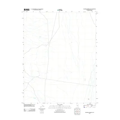
2012 Map of Deadman Spring NE
USGS Topo · Published 2012About this map
Two and One Half Spring serves as a vital water source in this arid stretch of Lincoln County, highlighting the sparse but critical hydrological network required for life and livestock in the high desert. The map captures a landscape defined by seasonal drainages and isolated landmarks, including the curiously named Swiss Bob Reservoir in the northwest. To the southeast, the terrain is marked by a distinct geological feature known as The Crack. The distribution of these few named points among an extensive network of unimproved roads and 4WD tracks reflects the remote character of eastern Nevada, where survival and travel are dictated by the location of reliable springs and man-made catchments.
Find a feature on this map
3 named features on this map. Tap any name to fly to it.
Don’t see what you’re looking for? This feature index may not catch every label — zoom into the map to look around manually.
Map Details
Editions of this 2012 Deadman Spring NE Map
This is the sole edition of this map. No revisions or reprints were ever made.
Other maps of this area

1885 · Pioche
USGS Topo · 1:250,000

1886 · Pioche
USGS Topo · 1:250,000

1915 · Bristol Range
USGS Topo · 1:62,500

1916 · Highland
USGS Topo · 1:62,500

1917 · Bristol Range
USGS Topo · 1:62,500

1918 · Highland
USGS Topo · 1:62,500

1954 · Caliente
USGS Topo · 1:250,000

1956 · Lund
USGS Topo · 1:250,000

1959 · Caliente
USGS Topo · 1:250,000

1960 · Lund
USGS Topo · 1:250,000