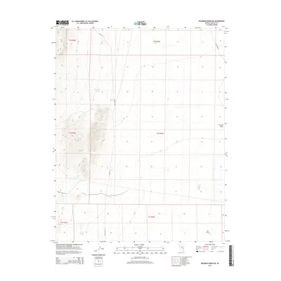
2014 Map of Deadman Spring NE
USGS Topo · Published 2014About this map
Dry Lake Valley dominates the eastern expanse of this Lincoln County landscape, showing the arid character of southeastern Nevada in the early twenty-first century. The topography is defined by significant elevation changes, particularly in the western sections where ridges overlook isolated water features like Swiss Bob Reservoir. A network of unpaved desert tracks, including Thorley Rd and Rattlesnake Rd, provides the primary infrastructure for navigating this basin. The presence of remote water sources such as Two and One Half Spring indicates the critical role of specific springs in supporting livestock or transit through these high-desert townships. Distinctive geological features, such as the depression known as The Crack, emphasize the unique erosional patterns found within the valley floor.
Find a feature on this map
14 named features on this map. Tap any name to fly to it.
Don’t see what you’re looking for? This feature index may not catch every label — zoom into the map to look around manually.
Map Details
Editions of this 2014 Deadman Spring NE Map
This is the sole edition of this map. No revisions or reprints were ever made.
Other maps of this area

1885 · Pioche
USGS Topo · 1:250,000

1886 · Pioche
USGS Topo · 1:250,000

1915 · Bristol Range
USGS Topo · 1:62,500

1916 · Highland
USGS Topo · 1:62,500

1917 · Bristol Range
USGS Topo · 1:62,500

1918 · Highland
USGS Topo · 1:62,500

1954 · Caliente
USGS Topo · 1:250,000

1956 · Lund
USGS Topo · 1:250,000

1959 · Caliente
USGS Topo · 1:250,000

1960 · Lund
USGS Topo · 1:250,000