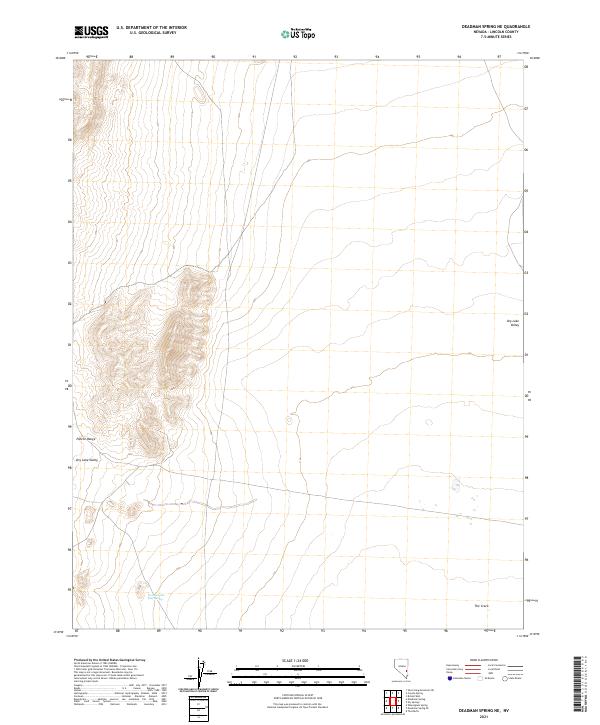
2021 Map of Deadman Spring NE
USGS Topo · Published 2021About this map
Pahroc Range rises along the western edge of this Lincoln County landscape, defining the transition into the broad expanse of Dry Lake Valley. The terrain is characterized by the stark geography of the Great Basin, where seasonal water sources like Two and One Half Spring provide critical points of interest in an otherwise arid environment. This 2021 survey by the U.S. Geological Survey details the township and range divisions across the valley floor, revealing a desert floor marked by subtle features such as The Crack in the southeastern quadrant. The map captures a high-resolution view of the section lines and topography that govern this isolated stretch of Nevada, reflecting the enduring cadastral framework of the American West.
Find a feature on this map
11 named features on this map. Tap any name to fly to it.
Don’t see what you’re looking for? This feature index may not catch every label — zoom into the map to look around manually.
Map Details
Editions of this 2021 Deadman Spring NE Map
This is the sole edition of this map. No revisions or reprints were ever made.
Other maps of this area

1885 · Pioche
USGS Topo · 1:250,000

1886 · Pioche
USGS Topo · 1:250,000

1915 · Bristol Range
USGS Topo · 1:62,500

1916 · Highland
USGS Topo · 1:62,500

1917 · Bristol Range
USGS Topo · 1:62,500

1918 · Highland
USGS Topo · 1:62,500

1954 · Caliente
USGS Topo · 1:250,000

1956 · Lund
USGS Topo · 1:250,000

1959 · Caliente
USGS Topo · 1:250,000

1960 · Lund
USGS Topo · 1:250,000