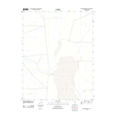
2012 Map of Deadman Spring SE
USGS Topo · Published 2012About this map
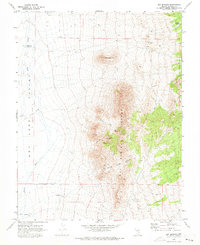
Sand Spring anchors the northwestern corner of this high-desert landscape in Lincoln County, Nevada, reflecting the critical importance of water sources in an arid region defined by seasonal drainages and managed catchment systems. The terrain is characterized by a series of north-south running valleys where drainage systems like Coyote Wash and Wheatgrass Wash dictate the movement of water across the basin. Human efforts to manage this intermittent resource are evident in the placement of several artificial basins, including Hirshi Reservoir Number Two, Bristol Reservoir Number Two, and Black Canyon Reservoir. These features suggest a landscape utilized for livestock ranching or local water storage, where small-scale infrastructure is necessary to sustain activity between the larger mountain ranges of the Great Basin.
Find a feature on this map
6 named features on this map. Tap any name to fly to it.
Don’t see what you’re looking for? This feature index may not catch every label — zoom into the map to look around manually.
Map Details
Editions of this 2012 Deadman Spring SE Map
This is the sole edition of this map. No revisions or reprints were ever made.
Other maps of this area

1885 · Pioche
USGS Topo · 1:250,000

1886 · Pioche
USGS Topo · 1:250,000

1916 · Highland
USGS Topo · 1:62,500

1918 · Highland
USGS Topo · 1:62,500

1954 · Caliente
USGS Topo · 1:250,000

1959 · Caliente
USGS Topo · 1:250,000
1970 · The Bluffs
USGS Topo · 1:24,000
1970 · Deadman Spring
USGS Topo · 1:24,000
1970 · Deadman Spring SE
USGS Topo · 1:24,000
1970 · Ely Springs
USGS Topo · 1:24,000