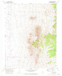
1970 Map of Ely Springs
USGS Topo · Published 1973About this map
Ely Springs Ranch serves as the primary human landmark in this arid portion of Lincoln County, situated near the southern base of the Ely Springs Range. The landscape is defined by its scarce but vital water sources, including the centrally located Tex Spring and Simpson Spring to the northeast. These springs, alongside the Swiss Bob Well, suggest a history of ranching and livestock management in an otherwise unforgiving terrain.
Find a feature on this map
19 named features on this map. Tap any name to fly to it.
Don’t see what you’re looking for? This feature index may not catch every label — zoom into the map to look around manually.
Map Details
Editions of this 1970 Ely Springs Map
This is the sole edition of this map. No revisions or reprints were ever made.
Other maps of this area

1885 · Pioche
USGS Topo · 1:250,000

1886 · Pioche
USGS Topo · 1:250,000

1915 · Bristol Range
USGS Topo · 1:62,500

1916 · Highland
USGS Topo · 1:62,500

1917 · Bristol Range
USGS Topo · 1:62,500

1918 · Highland
USGS Topo · 1:62,500

1953 · Highland Peak
USGS Topo · 1:24,000

1953 · Bristol Range SE
USGS Topo · 1:24,000

1954 · Caliente
USGS Topo · 1:250,000

1956 · Lund
USGS Topo · 1:250,000