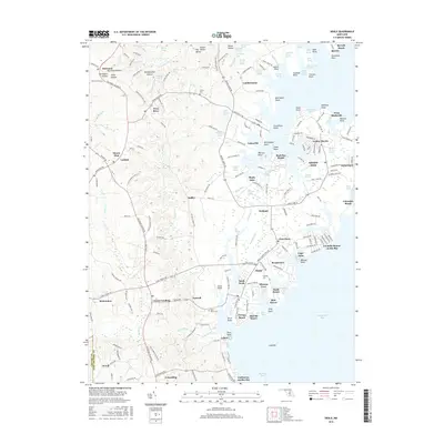
2016 Map of Deale
USGS Topo · Published 2016About this map
Chesapeake Bay waters define the eastern edge of this landscape, where the tides meet a series of established waterfront communities and expansive marshlands. The shoreline is deeply indented by complex inlets like Smith Creek and Deep Cove Creek, which separate settlements such as Galesville, Shady Side, and Deale. Further inland, the terrain transitions into a mosaic of hollows and small valleys, including Harwood Hollow and Hornbeam Hollow, alongside historic hubs like Lothian and Tracys Landing.
Find a feature on this map
211 named features on this map. Tap any name to fly to it.
Don’t see what you’re looking for? This feature index may not catch every label — zoom into the map to look around manually.
Map Details
Editions of this 2016 Deale Map
This is the sole edition of this map. No revisions or reprints were ever made.
Other maps of this area

1892 · Prince Frederick
USGS Topo · 1:62,500

1892 · Owensville
USGS Topo · 1:62,500

1892 · Annapolis
USGS Topo · 1:62,500

1893 · Sharps Island
USGS Topo · 1:62,500

1895 · Prince Frederick
USGS Topo · 1:62,500

1895 · Owensville
USGS Topo · 1:62,500

1898 · Choptank
USGS Topo · 1:125,000

1899 · Patuxent
USGS Topo · 1:125,000

1901 · Prince Frederick
USGS Topo · 1:62,500

1904 · Annapolis
USGS Topo · 1:62,500