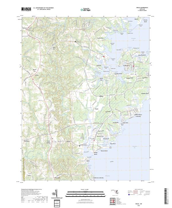
2023 Map of Deale
USGS Topo · Published 2023About this map
The western shores of the Chesapeake Bay define this region, where tidal inlets and marshy creek mouths create a highly articulated coastline. Galesville and Deale serve as central points for a landscape characterized by numerous small waterfront communities like Avalon Shores and Franklin Manor-on-the-Bay. The map reveals the intricate drainage patterns of the coastal plain, with features such as The Swamp and Lerch Creek Marsh punctuating the low-lying terrain.
Find a feature on this map
225 named features on this map. Tap any name to fly to it.
Don’t see what you’re looking for? This feature index may not catch every label — zoom into the map to look around manually.
Map Details
Editions of this 2023 Deale Map
This is the sole edition of this map. No revisions or reprints were ever made.
Other maps of this area

1892 · Prince Frederick
USGS Topo · 1:62,500

1892 · Owensville
USGS Topo · 1:62,500

1892 · Annapolis
USGS Topo · 1:62,500

1893 · Sharps Island
USGS Topo · 1:62,500

1895 · Prince Frederick
USGS Topo · 1:62,500

1895 · Owensville
USGS Topo · 1:62,500

1898 · Choptank
USGS Topo · 1:125,000

1899 · Patuxent
USGS Topo · 1:125,000

1901 · Prince Frederick
USGS Topo · 1:62,500

1904 · Annapolis
USGS Topo · 1:62,500