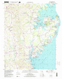
1997 Map of Deale
USGS Topo · Published 1999About this map
Galesville and Deale anchor this coastal survey of the western shore of the Chesapeake Bay, where the land is defined by deeply recessed tidal inlets and established maritime communities. The complex shoreline is a maze of named points and coves, from Deadwood Cove and Tenthouse Creek to the recreational hubs at Avalon Shores and Shady Side. This area, long a center for Maryland’s maritime culture, shows a dense network of residential developments and historic institutional landmarks like Franklin Memorial Church and the Southern High School.
Find a feature on this map
133 named features on this map. Tap any name to fly to it.
Don’t see what you’re looking for? This feature index may not catch every label — zoom into the map to look around manually.
Map Details
Editions of this 1997 Deale Map
This is the sole edition of this map. No revisions or reprints were ever made.
Other maps of this area

1892 · Prince Frederick
USGS Topo · 1:62,500

1892 · Owensville
USGS Topo · 1:62,500

1892 · Annapolis
USGS Topo · 1:62,500

1893 · Sharps Island
USGS Topo · 1:62,500

1895 · Prince Frederick
USGS Topo · 1:62,500

1895 · Owensville
USGS Topo · 1:62,500

1898 · Choptank
USGS Topo · 1:125,000

1899 · Patuxent
USGS Topo · 1:125,000

1901 · Prince Frederick
USGS Topo · 1:62,500

1904 · Annapolis
USGS Topo · 1:62,500