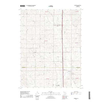
2017 Map of Dearborn
USGS Topo · Published 2017About this map
Dearborn and Faucett anchor the landscape of this 2017 survey, which straddles the boundary between Buchanan Co and Platte Co. The area is defined by a dense network of country roads and family-named cemeteries, reflecting generations of rural settlement in northwest Missouri. Significant clusters of history are found at New Market and the smaller locality of Taos, while the legacy of early transportation is visible in the alignment of Rock Island Dr and NW Interurban Rd. Water features like Antioch Lake, Trickey Lake, and the Dearborn Reservoir dot the terrain alongside winding branches such as Bee Creek and Blizzard Branch. Genealogists will find a high concentration of burial sites, from Antioch Cemetery to Yates Cemetery and Hackett Cemetery, documenting the families who shaped these communities.
Find a feature on this map
61 named features on this map. Tap any name to fly to it.
Don’t see what you’re looking for? This feature index may not catch every label — zoom into the map to look around manually.
Map Details
Editions of this 2017 Dearborn Map
This is the sole edition of this map. No revisions or reprints were ever made.
Other maps of this area

1890 · Kansas City
USGS Topo · 1:125,000

1894 · Kansas City
USGS Topo · 1:125,000

1910 · Leavenworth
USGS Topo · 1:62,500

1914 · Smithville
USGS Topo · 1:62,500

1925 · Gower
USGS Topo · 1:62,500

1927 · Dearborn
USGS Topo · 1:62,500

1948 · Leavenworth
USGS Topo · 1:62,500

1950 · Kansas City
USGS Topo · 1:250,000
1950 · Smithville
USGS Topo · 1:62,500

1951 · Edgerton
USGS Topo · 1:24,000