
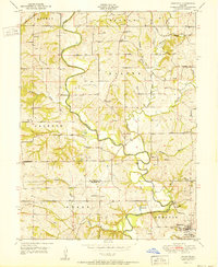
1951 Map of Edgerton
USGS Topo · Published 1951About this map
The Platte River meanders sharply across this rural landscape, carving a deep valley that separates the townships of Agency, Tremont, and Jackson. At the southern edge of the survey, the village of Edgerton sits near the riverbank, serving as a local hub for a network of family-run farms and country institutions. The 1950s terrain is heavily marked by decentralized education and faith, evidenced by the numerous district schools and rural chapels that dot the map, such as School No 5, Burnett Sch, and Frazer Ch.
Find a feature on this map
41 named features on this map. Tap any name to fly to it.
Don’t see what you’re looking for? This feature index may not catch every label — zoom into the map to look around manually.
Map Details
Editions of this 1951 Edgerton Map
2 editions found
Other maps of this area

1890 · Kansas City
USGS Topo · 1:125,000

1894 · Kansas City
USGS Topo · 1:125,000

1910 · Leavenworth
USGS Topo · 1:62,500

1914 · Smithville
USGS Topo · 1:62,500

1925 · Gower
USGS Topo · 1:62,500

1927 · Dearborn
USGS Topo · 1:62,500

1948 · Leavenworth
USGS Topo · 1:62,500

1950 · Kansas City
USGS Topo · 1:250,000
1950 · Smithville
USGS Topo · 1:62,500
1951 · Smithville
USGS Topo · 1:24,000