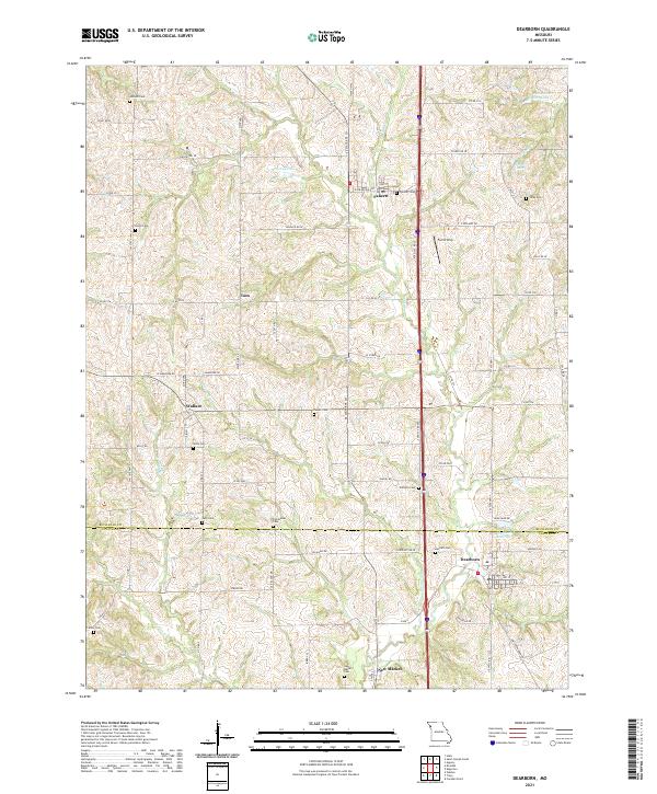
2021 Map of Dearborn
USGS Topo · Published 2021About this map
Dearborn and the surrounding agricultural landscapes of the Buchanan Co and Platte Co border are defined by a dense network of country cemeteries and small hamlets. The terrain is deeply carved by watercourses like Bee Cr and Bleazard Br, which dictate the winding paths of rural routes such as Willis Rd and SE Mumford Rd. The settlement pattern reflects long-standing community centers at Faucett, New Market, and Wallace, each serving as a focal point for the surrounding farmsteads. Genealogists will find a wealth of data across the quadrangle, with numerous family and community burial grounds including Union Cem, Yates Cem, and Richardson Cem. Industrial and utility features are sparse but significant, including the Dearborn Reservoir and the Farris Strip landing area, which contrast with the primarily agrarian character of the Missouri interior.
Find a feature on this map
61 named features on this map. Tap any name to fly to it.
Don’t see what you’re looking for? This feature index may not catch every label — zoom into the map to look around manually.
Map Details
Editions of this 2021 Dearborn Map
This is the sole edition of this map. No revisions or reprints were ever made.
Other maps of this area

1890 · Kansas City
USGS Topo · 1:125,000

1894 · Kansas City
USGS Topo · 1:125,000

1910 · Leavenworth
USGS Topo · 1:62,500

1914 · Smithville
USGS Topo · 1:62,500

1925 · Gower
USGS Topo · 1:62,500

1927 · Dearborn
USGS Topo · 1:62,500

1948 · Leavenworth
USGS Topo · 1:62,500

1950 · Kansas City
USGS Topo · 1:250,000
1950 · Smithville
USGS Topo · 1:62,500

1951 · Edgerton
USGS Topo · 1:24,000