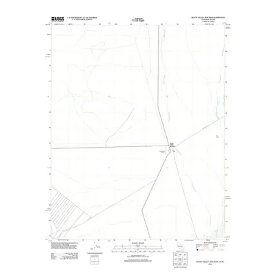
2012 Map of Death Valley Junction
USGS Topo · Published 2012About this map
Death Valley Junction serves as the primary hub of this high-desert landscape, situated where the Amargosa River ephemeral drainage meets significant transit routes. The settlement's unique layout and the presence of the Amargosa Airport reflect its role as a remote crossroads between the California and Nevada borderlands. The terrain is defined by the hydrologic patterns of the river and the Carson Slough, which weave through the desert floor near Hog Ranch. Significant regional access is provided via Ash Meadows Rd and Potero Rd, which cut through the open spaces of Inyo County. This 2012 survey captures the spatial organization of this isolated desert community, highlighting the infrastructure necessary for life and travel in the arid Amargosa Valley.
Find a feature on this map
7 named features on this map. Tap any name to fly to it.
Don’t see what you’re looking for? This feature index may not catch every label — zoom into the map to look around manually.
Map Details
Editions of this 2012 Death Valley Junction Map
This is the sole edition of this map. No revisions or reprints were ever made.
Other maps of this area

1908 · Furnace Creek
USGS Topo · 1:250,000

1910 · Furnace Creek
USGS Topo · 1:250,000

1940 · Eagle Tank
USGS Topo · 1:62,500

1948 · Death Valley
USGS Topo · 1:250,000

1951 · Funeral Peak
USGS Topo · 1:62,500

1951 · Eagle Mtn
USGS Topo · 1:62,500

1952 · Ash Meadows
USGS Topo · 1:62,500

1952 · Ryan
USGS Topo · 1:62,500

1954 · Death Valley
USGS Topo · 1:250,000

1956 · Death Valley
USGS Topo · 1:250,000