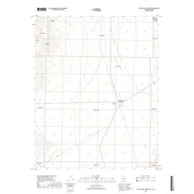
2018 Map of Death Valley Junction
USGS Topo · Published 2018About this map
Death Valley Junction stands as the primary outpost in this desert landscape, positioned near the intersection of major state routes as they cross the Mojave Desert. The topography is dominated by the dramatic rise of the Funeral Mountains and the southern edge of the Amargosa Range, including the distinct peak of Bat Mtn. This 2018 survey illustrates the hydrological character of the region, where the Amargosa River and Carson Slough weave through the arid basin. Near the settlement, the Amargosa Airport serves as a remote waypoint for the sparsely populated borderlands of Inyo County. To the south, Potero Rd cuts through the desert floor, providing access across the grid of township and range lines that define the eastern edge of California against the Nevada state line.
Find a feature on this map
19 named features on this map. Tap any name to fly to it.
Don’t see what you’re looking for? This feature index may not catch every label — zoom into the map to look around manually.
Map Details
Editions of this 2018 Death Valley Junction Map
This is the sole edition of this map. No revisions or reprints were ever made.
Other maps of this area

1908 · Furnace Creek
USGS Topo · 1:250,000

1910 · Furnace Creek
USGS Topo · 1:250,000

1940 · Eagle Tank
USGS Topo · 1:62,500

1948 · Death Valley
USGS Topo · 1:250,000

1951 · Funeral Peak
USGS Topo · 1:62,500

1951 · Eagle Mtn
USGS Topo · 1:62,500

1952 · Ash Meadows
USGS Topo · 1:62,500

1952 · Ryan
USGS Topo · 1:62,500

1954 · Death Valley
USGS Topo · 1:250,000

1956 · Death Valley
USGS Topo · 1:250,000