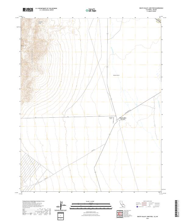
2021 Map of Death Valley Junction
USGS Topo · Published 2021About this map
Death Valley Junction serves as the central hub of this desert landscape, situated at the intersection of critical regional routes. The map illustrates the convergence of transit and terrain where the Mojave Desert meets the rising elevations of the Funeral Mountains and the Amargosa Range. This area is defined by its intermittent water systems, most notably the Amargosa River and the Carson Slough, which trace through the arid valley floor. The placement of Amargosa Airport and the sparse road network, including Ash Meadows Rd and Potero Rd, highlights the remote character of this border region. Straddling the line between California and Nevada, the map provides a precise look at the township and range divisions that organized this corner of Inyo County, anchored by landmarks like Bat Mtn.
Find a feature on this map
11 named features on this map. Tap any name to fly to it.
Don’t see what you’re looking for? This feature index may not catch every label — zoom into the map to look around manually.
Map Details
Editions of this 2021 Death Valley Junction Map
This is the sole edition of this map. No revisions or reprints were ever made.
Other maps of this area

1908 · Furnace Creek
USGS Topo · 1:250,000

1910 · Furnace Creek
USGS Topo · 1:250,000

1940 · Eagle Tank
USGS Topo · 1:62,500

1948 · Death Valley
USGS Topo · 1:250,000

1951 · Funeral Peak
USGS Topo · 1:62,500

1951 · Eagle Mtn
USGS Topo · 1:62,500

1952 · Ash Meadows
USGS Topo · 1:62,500

1952 · Ryan
USGS Topo · 1:62,500

1954 · Death Valley
USGS Topo · 1:250,000

1956 · Death Valley
USGS Topo · 1:250,000