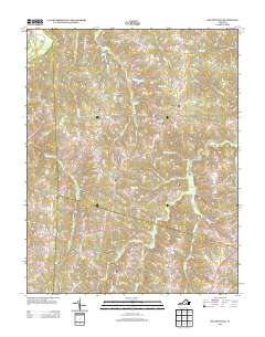
2013 Map of Deatonville
USGS Topo · Published 2013About this map
Deatonville and the surrounding Amelia County countryside are defined by a dense network of tributaries feeding into the Appomattox River along the northern boundary. The landscape is characterized by its agricultural and residential settlement patterns, centered on small hubs like Rodophil and Gills. Waterways such as Saylers Cr and Flat Cr carve through the terrain, historically influencing the placement of local thoroughfares like Saylers Creek Rd and Morrissetts Mill Rd.
Find a feature on this map
58 named features on this map. Tap any name to fly to it.
Don’t see what you’re looking for? This feature index may not catch every label — zoom into the map to look around manually.
Map Details
Editions of this 2013 Deatonville Map
This is the sole edition of this map. No revisions or reprints were ever made.
Other maps of this area

1891 · Farmville
USGS Topo · 1:125,000

1893 · Farmville
USGS Topo · 1:125,000

1947 · Roanoke
USGS Topo · 1:250,000

1958 · Farmville
USGS Topo · 1:62,500

1958 · Jetersville
USGS Topo · 1:62,500

1958 · Crewe
USGS Topo · 1:62,500

1958 · Keysville
USGS Topo · 1:62,500

1959 · Roanoke
USGS Topo · 1:250,000

1963 · Roanoke
USGS Topo · 1:250,000
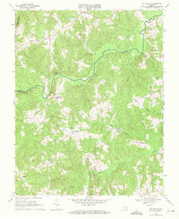
1968 · Ballsville
USGS Topo · 1:24,000