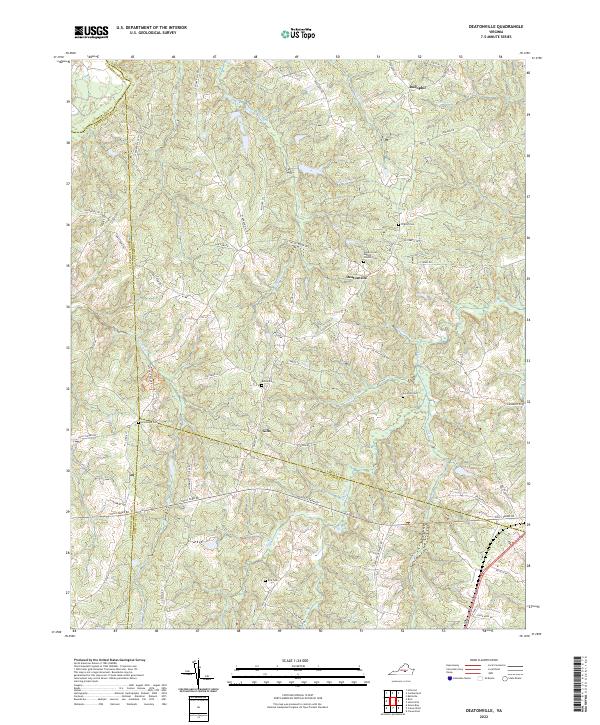
2022 Map of Deatonville
USGS Topo · Published 2022About this map
Deatonville and the surrounding Amelia County countryside are defined by a complex network of stream valleys and family cemeteries in this recent survey. The landscape is carved by the headwaters of Saylers Creek and the winding course of Flat Cr, which separate the small settlements of Rodophil in the north from Gills further south. This rural area reflects a long-standing settlement pattern where community life centered around local churches and burial grounds. Genealogists will find a high density of historically significant sites, including Sandy Creek Baptist Church Cem, Pilgrim Cem, and Star Hope Cem. The convergence of several county boundaries, including those of Nottoway, Prince Edward, and Cumberland, highlights the importance of this region as a jurisdictional crossroads in Virginia's Piedmont. Modern road networks like S Genito Rd and Rodophil Rd follow historical corridors that have connected these farmsteads and creek crossings for generations.
Find a feature on this map
69 named features on this map. Tap any name to fly to it.
Don’t see what you’re looking for? This feature index may not catch every label — zoom into the map to look around manually.
Map Details
Editions of this 2022 Deatonville Map
This is the sole edition of this map. No revisions or reprints were ever made.
Other maps of this area

1891 · Farmville
USGS Topo · 1:125,000

1893 · Farmville
USGS Topo · 1:125,000

1947 · Roanoke
USGS Topo · 1:250,000

1958 · Farmville
USGS Topo · 1:62,500

1958 · Jetersville
USGS Topo · 1:62,500

1958 · Crewe
USGS Topo · 1:62,500

1958 · Keysville
USGS Topo · 1:62,500

1959 · Roanoke
USGS Topo · 1:250,000

1963 · Roanoke
USGS Topo · 1:250,000
1968 · Ballsville
USGS Topo · 1:24,000