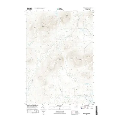
2016 Map of Debar Mountain
USGS Topo · Published 2016About this map
Loon Lake Mountains and the massive profile of Debar Mountain dominate this landscape within the Adirondack Park Preserve. The topography is defined by high peaks and an intricate network of waterways, including the North Branch Saranac River and its various tributaries like Hatch Brook and Hays Brook. In the southeast, Lake Kushaqua and the Kushaqua Narrows provide a distinct contrast to the surrounding elevations of the Sable Mountains.
Find a feature on this map
31 named features on this map. Tap any name to fly to it.
Don’t see what you’re looking for? This feature index may not catch every label — zoom into the map to look around manually.
Map Details
Editions of this 2016 Debar Mountain Map
This is the sole edition of this map. No revisions or reprints were ever made.
Other maps of this area

1902 · Saranac
USGS Topo · 1:62,500

1904 · Saranac
USGS Topo · 1:62,500

1905 · Saint Regis
USGS Topo · 1:62,500

1906 · Loon Lake
USGS Topo · 1:62,500

1908 · Loon Lake
USGS Topo · 1:62,500

1921 · Santa Clara
USGS Topo · 1:62,500

1923 · Santa Clara
USGS Topo · 1:62,500

1948 · Ogdensburg
USGS Topo · 1:250,000

1951 · Ogdensburg
USGS Topo · 1:250,000

1953 · Ogdensburg
USGS Topo · 1:250,000