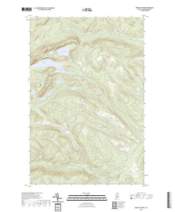
2024 Map of Deboullie Pond
USGS Topo · Published 2024About this map
Deboullie Pond and its surrounding peaks define this remote interior landscape of northern Maine. The terrain is characterized by a concentrated cluster of glacial ponds, including Pushineer Pond, Fish Pond, and Island Pond, all sheltered by the prominent elevations of Deboullie Mtn, Black Mtn, and Whitman Mtn. This high-elevation watershed feeds a complex network of streams, notably the Red River and its several numbered tributaries such as Threemile Brook and Fivemile Brook.
Find a feature on this map
23 named features on this map. Tap any name to fly to it.
Don’t see what you’re looking for? This feature index may not catch every label — zoom into the map to look around manually.
Map Details
Editions of this 2024 Deboullie Pond Map
This is the sole edition of this map. No revisions or reprints were ever made.
Other maps of this area

1928 · Eagle Lake
USGS Topo · 1:48,000

1928 · Winterville
USGS Topo · 1:48,000

1930 · St Francis
USGS Topo · 1:48,000

1931 · Fish River Lake
USGS Topo · 1:48,000

1931 · Eagle Lake
USGS Topo · 1:62,500

1931 · Winterville
USGS Topo · 1:62,500

1933 · St Francis
USGS Topo · 1:62,500

1935 · Fish River Lake
USGS Topo · 1:62,500

1954 · Presque Isle
USGS Topo · 1:250,000

1958 · Presque Isle
USGS Topo · 1:250,000