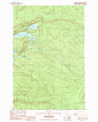
1985 Map of Deboullie Pond
USGS Topo · Published 1986About this map
Black Mountain and Whitman Mountain dominate the northern landscape of this remote Maine territory, an area defined by its cluster of interconnected glacial lakes and high-elevation ponds. The Red River Camps and numerous Campgrounds near Pushineer Pond and Perch Pond indicate a long-standing culture of seasonal sporting and timber management in the Maine North Woods. The presence of a Lookout Tower on the heights above Deboullie Pond highlights the importance of fire surveillance in this heavily forested region.
Find a feature on this map
30 named features on this map. Tap any name to fly to it.
Don’t see what you’re looking for? This feature index may not catch every label — zoom into the map to look around manually.
Map Details
Editions of this 1985 Deboullie Pond Map
This is the sole edition of this map. No revisions or reprints were ever made.
Other maps of this area

1928 · Eagle Lake
USGS Topo · 1:48,000

1928 · Winterville
USGS Topo · 1:48,000

1930 · St Francis
USGS Topo · 1:48,000

1931 · Fish River Lake
USGS Topo · 1:48,000

1931 · Eagle Lake
USGS Topo · 1:62,500

1931 · Winterville
USGS Topo · 1:62,500

1933 · St Francis
USGS Topo · 1:62,500

1935 · Fish River Lake
USGS Topo · 1:62,500

1954 · Presque Isle
USGS Topo · 1:250,000

1958 · Presque Isle
USGS Topo · 1:250,000